
The 18th beyond the hill · Guide 2026
Halle Pajol and Rosa Luxemburg gardens
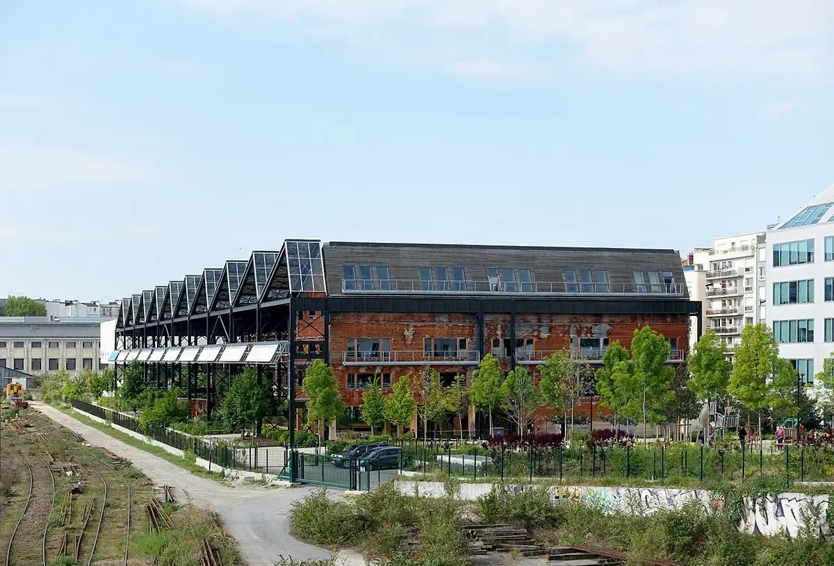
This walk crosses a redeveloped former railway area in the 18th. The Rosa Luxemburg gardens connect Halle Pajol with rue Riquet and rue Pajol. The area under the hall is sheltered, and the playgrounds are outdoors.
Date listed by the source: 2017-04-23 09:45. Resized and converted to WebP. This image does not establish the venue’s present condition.
The short answer
What matters before you go.
Choose Pajol as a walk in its own right. Use the entrance on the City listing, observe the contrast between sheltered and open areas, then allow time for a break. This garden is not at the foot of Sacré-Cœur: plan the journey separately.
Action plan
The route,
step by step.
Times and order are guideposts. Always adapt the visit to crowds, actual access and your group’s energy.
Plan the detour
Compare your starting point with the City’s entrances. Add this area to a day in the 18th rather than squeezing it between summit appointments. Use a map to judge the journey; sharing an arrondissement is not enough.
Read the conversion
Look at the Halle’s large structure and the site’s present uses. Then compare with the clearly labelled archive. An old photograph documents a stage; it does not establish present access or open services.
Distinguish the spaces
The sheltered part does not turn the whole garden into an indoor facility. Choose a break suited to wind, rain and that day’s hours. Facilities listed by the City still need checking on site.
Build a realistic continuation
Continue from Riquet or the esplanade without assuming every building provides a through-route. If continuing to a cultural venue, check its public entrance and programme separately from the garden’s.
Understand more · choose well
Read the hill before choosing a street.
A short line on the map can combine steps, slopes and cobbles. Build a walk around an arrival point, a chosen ascent and an exit; this helps more than a list of sights to tick off.
The summit: save your energy
Place du Tertre, rue Cortot and the Sacré-Cœur forecourt connect on foot. Crowds may slow progress. Keep an option to leave the busiest streets and avoid making the summit your last stop if you need a quick departure.
The northern side: another perspective
Rues de l’Abreuvoir, des Saules and Saint-Vincent reveal gardens, vines and façades. A quieter street is not necessarily flatter. Check the return route before descending and keep residential entrances clear.
The foot of the hill: a place to finish
Abbesses, Blanche and Anvers are separate landmarks. Choose an exit to suit the rest of your day, then check the actual journey on a transport map. For mobility requirements, verify each segment: a street without steps can still be difficult.
Look closer
Details that tell the story of a place
1926 · 2004
Jardins Rosa Luxemburg
Built in 1926, the former railway hall was bought by the City in 2004. Its conversion combines a library, gardens, shops and youth hostel.
Look for. From public space, trace the structure and its new uses.
Mairie du 18e · M18, 2025, p. 10–11 (PDF) ↗Useful trade-offs
What really changes the visit.
A real break
Allow time to observe industrial heritage, vegetation and everyday uses together. The detour deserves more than a photograph from a vehicle.
Seasonal hours
The City publishes opening periods. Check your visit date; October hours do not describe the entire year.
Practical questions
Before confirming the route.
Is this a summit garden?+
No. It is in another part of the 18th; plan the journey separately.
Is the entire garden sheltered?+
No. The City listing distinguishes sheltered and open areas.
Check on the day
Official and practical sources.
Hours, outages, works, prices and access conditions change. For any important requirement, check the relevant source and contact the venue directly.
